Multibeam Bathymetry (MBES)
Full-coverage, high-resolution seabed mapping with tightly controlled positioning and sound-velocity correction.
CS Marineland delivers high-precision marine geophysical surveys and turnkey submarine cable installation — engineered for oil & gas, telecom, environmental and archaeology projects across the Caribbean and Latin America.
Field-proven operations, survey-grade data.
Based in Cartagena, Colombia, Construcciones y Servicios Marineland S.A.S. (NIT 901.366.891-5) is a marine survey and submarine cable specialist working across the Caribbean and Latin America. We pair hands-on offshore experience with rigorous, ISO-certified processes — so every project ends in clear, decision-ready deliverables, in the datum and format you need.
Founded in 2020, the company is young — but our team brings decades of combined offshore survey and submarine-cable experience to every mobilization. From a single-day site visit to a full turnkey cable campaign, we scope the work around your objectives, standards and schedule.
At CS Marineland we solve the most demanding technical challenges in hydrography, marine geophysics and subsea infrastructure — telecommunications and oil & gas — with international standards and tailor-made solutions. We do not aim to be the largest, but the best in specialized, high-value niches: getting to know each client and their operation in depth to develop the solution they truly need, acting as a technical and cultural bridge between global operators from Europe, Asia and North America and the realities of Latin America.
To be Latin America's benchmark firm in the specialized, high-value niches of hydrography, marine geophysics and subsea infrastructure — telecommunications and oil & gas — recognised not for its size but for being the best: for the quality of its products, its tailor-made solutions, and for always staying at the forefront, bringing the world's most advanced solutions to the region.
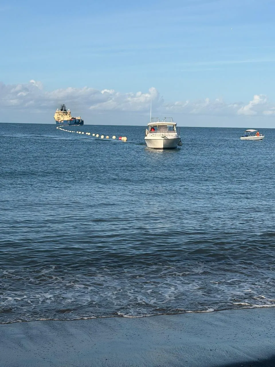
Survey, engineering and installation under one point of responsibility — see the deliverables and field operations from our campaigns.
A complete geophysical and geotechnical toolkit for the seabed and sub-seabed — deployed from survey vessels of any size, anywhere in the region.
Full-coverage, high-resolution seabed mapping with tightly controlled positioning and sound-velocity correction.
Imaging of shallow stratigraphy and sediment layers for burial assessment, geohazards and foundations.
High-definition seabed imagery for targets, debris, boulders, cables and habitat characterisation.
Detection of ferrous objects, UXO, pipelines and cables through precise magnetic-field gradient mapping.
Marine seismic sources for higher-energy sub-bottom penetration where deeper geology matters.
Marine ERT for sub-seabed resistivity imaging — sediment type, freshwater lenses and burial conditions.
2D HR seismic reflection for detailed sub-surface structure in oil & gas and engineering studies.
Remotely operated vehicles for visual inspection, positioning support and light intervention tasks.
Autonomous underwater vehicles for efficient, high-quality deep-water and long-line acquisition.
Piston, vibro and box corers for sediment sampling, geotechnical characterisation and environmental baselines.
CS Marineland delivers turnkey submarine cable projects — survey, route design, engineering, supervision, installation (lay, burial, shore end) and quality assurance — as principal contractor and single point of responsibility, combining our in-house capability with a network of specialised partner companies for each project.
Desktop studies, route engineering and burial assessment optimised for cost, risk and permitting.
Precision installation and floating of the shore end ahead of the main lay campaign.
Beach pull-in with cable grabs and shore plant, burial and BMH tie-in — our field signature.
Turn-key laying of non-repeated fibre and power cables between coasts, islands and platforms.
Single-point delivery: permits, survey, engineering, installation, protection and as-built.
Coastal and marine reconnaissance, CSR support and constructability reviews before mobilisation.
The same survey and installation expertise, tuned to the standards and deliverables each industry demands.
Site surveys, route & hazard studies, rig positioning and pre-engineering geophysics for offshore developments.
Route design, shore ends and installation for fibre-optic and power interconnectors between coasts and islands.
Baseline studies, benthic & coral characterisation and geophysical support for environmental permitting.
Detection, mapping and documentation of wrecks and heritage using SSS, magnetometry and sub-bottom data.
An owned and partner instrument fleet covering from the beach to 3,000 m depth — anchored by our flagship wideband multibeam.
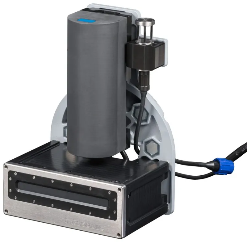
Wideband multibeam echo sounder, 200–450 kHz tunable, with TruePix co-registered backscatter — bathymetry and seabed imagery in one pass.
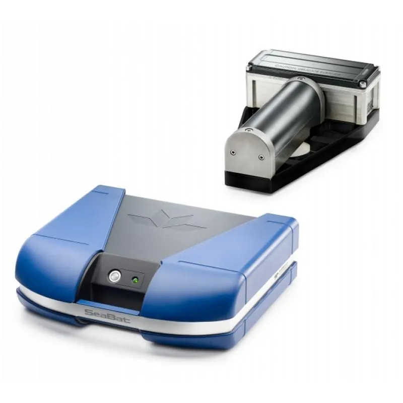
High-density multibeam for precision bathymetry and target detection.
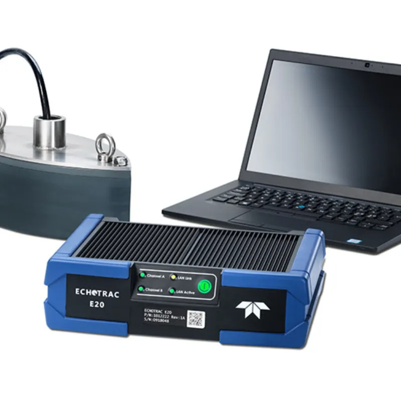
Precision dual-frequency single-beam echo sounder for shallow and transitional waters.
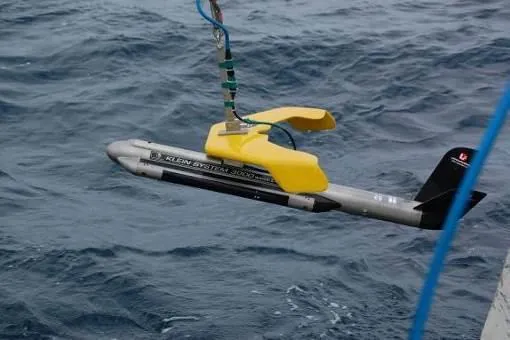
Digital dual-frequency side scan sonars for high-resolution seabed imagery and target detection.
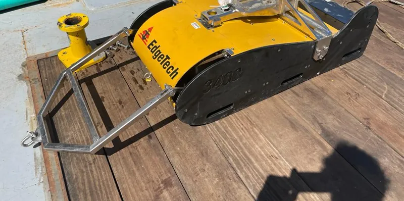
Towed Chirp sub-bottom profiler for high-resolution shallow stratigraphy.
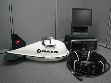
Dual-frequency Chirp III sub-bottom profiler for high-definition shallow stratigraphy.
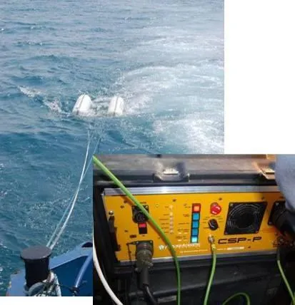
Boomer seismic source for high-penetration stratigraphic profiling.
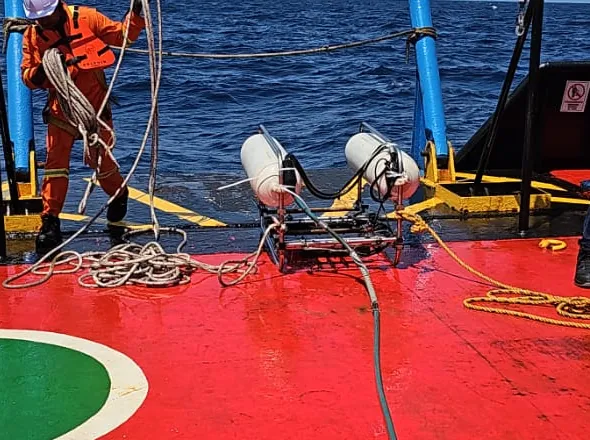
High-energy sparker source for deeper sub-bottom penetration and reflection seismics.
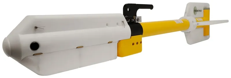
Marine caesium magnetometer for ferrous target, UXO, cable and pipeline detection.
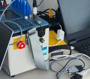
Multichannel resistivity meter for marine electrical resistivity tomography (ERT).
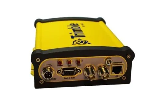
Dual-antenna positioning with RTK/RTX corrections for navigation control.
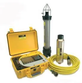
USBL acoustic positioning of towed sensors and ROVs.
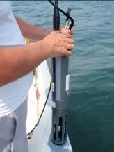
Conductivity, temperature and depth profiles to characterise the water column.
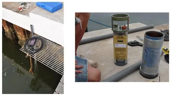
Tide measurement for the vertical reduction of bathymetry in coastal areas.
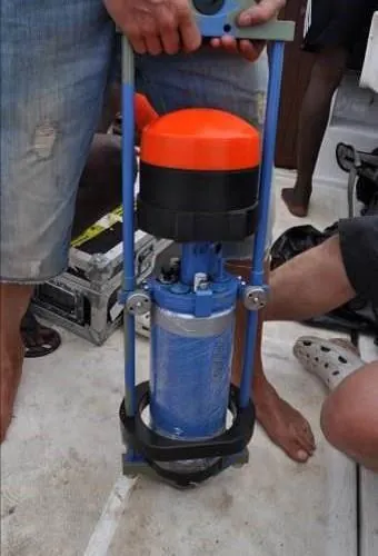
Current profilers for oceanographic and met-ocean studies.
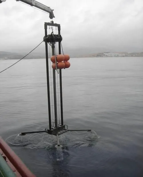
Vibrocorers for sediment sampling to ~600 m depth, 3–6 m penetration.
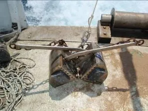
Grab and box corers for surface seabed sampling and geotechnical baselines.
Continuously investing. We keep expanding our instrument fleet and maintain rental agreements with international houses, so each project is equipped to its exact requirement — up to 3,000 m depth.
A selection of survey deliverables and field operations from campaigns run by our team. Location and client data withheld for confidentiality.
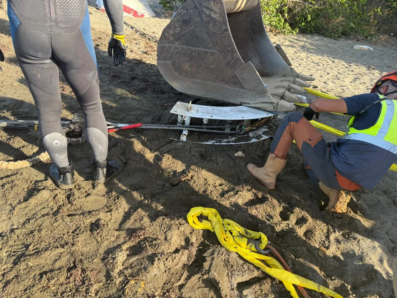
Beach pull-in, ducting and jointing with diving and survey support.
Float-out from the cable-lay vessel toward the shore, with progressive lay-down.
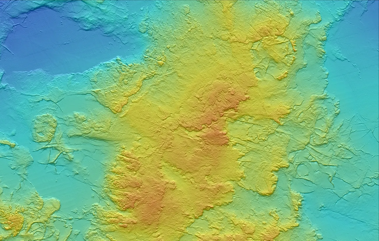
Colour-shaded seabed DEM from full-coverage MBES.
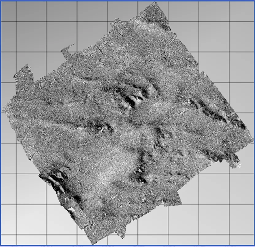
Seabed reflectivity co-registered with the bathymetry.
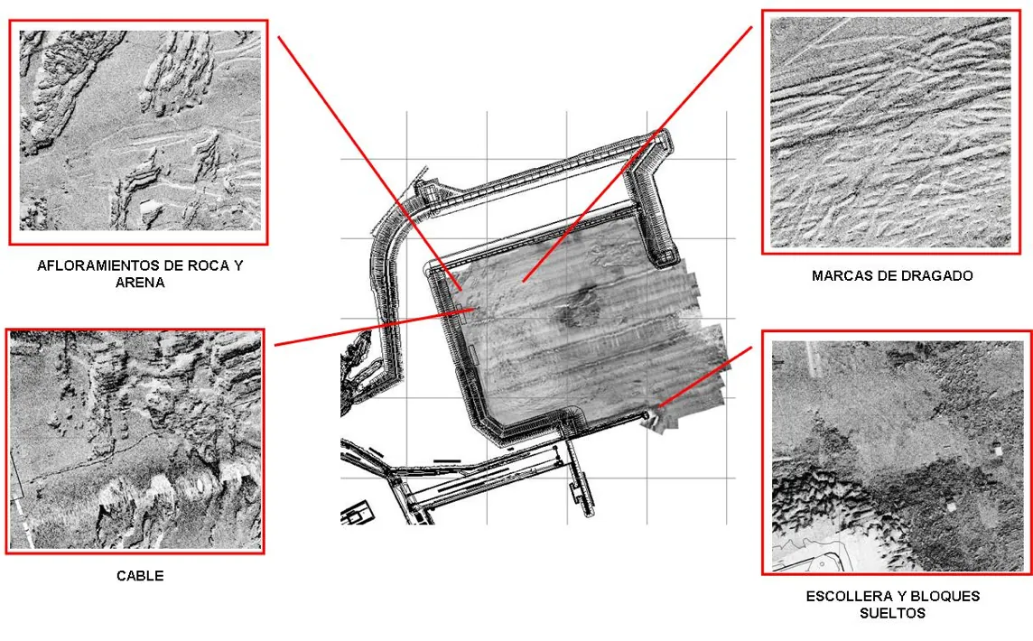
Rock, dredging marks, cables and riprap identified along the survey.
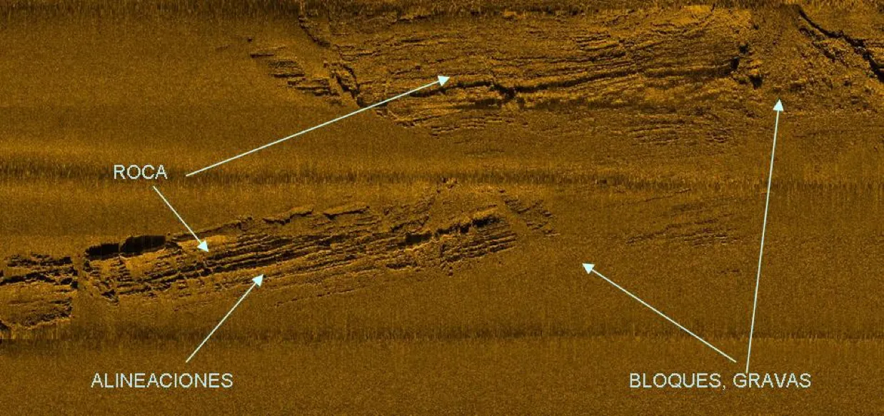
Rock, lineations and blocks/gravel from side scan sonar.
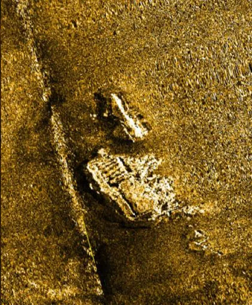
Targets and structures resolved on the seabed with acoustic shadow.
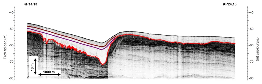
Interpreted seabed pick and sub-surface reflector horizons.
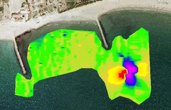
Ferrous targets detected along the corridor.
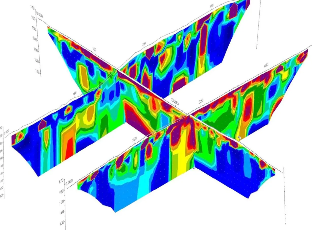
3D fence model of sub-seabed resistivity.
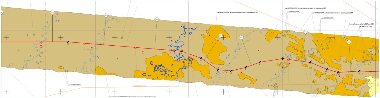
Route corridor plan with seabed classification and KP.
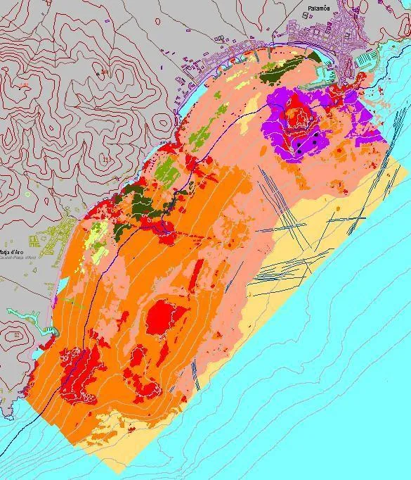
Interpreted seabed facies and morphology.
Shaded 3D digital terrain model of the seabed.
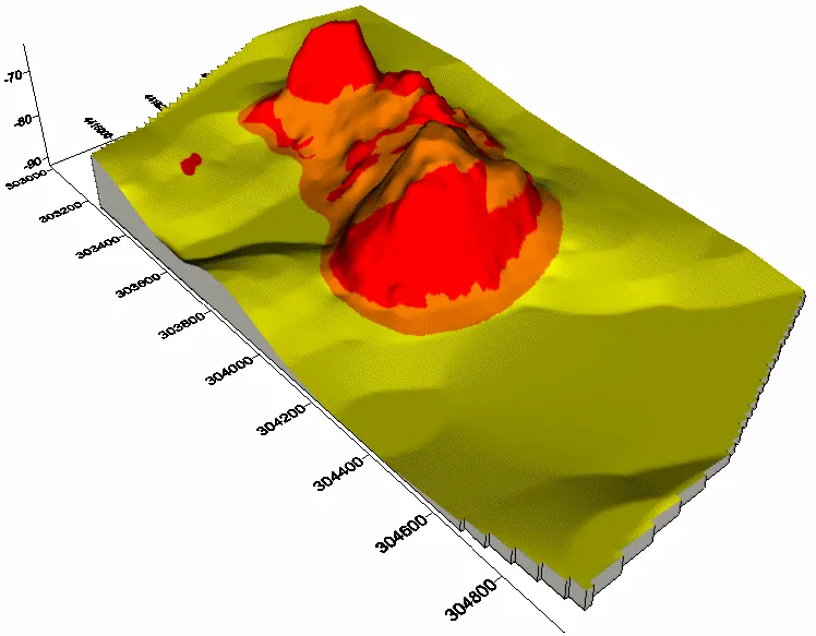
Seabed facies rendered in three dimensions.
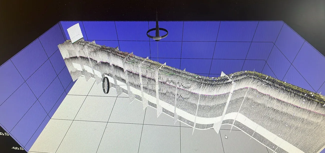
Interpreted reflector horizons along the corridor.
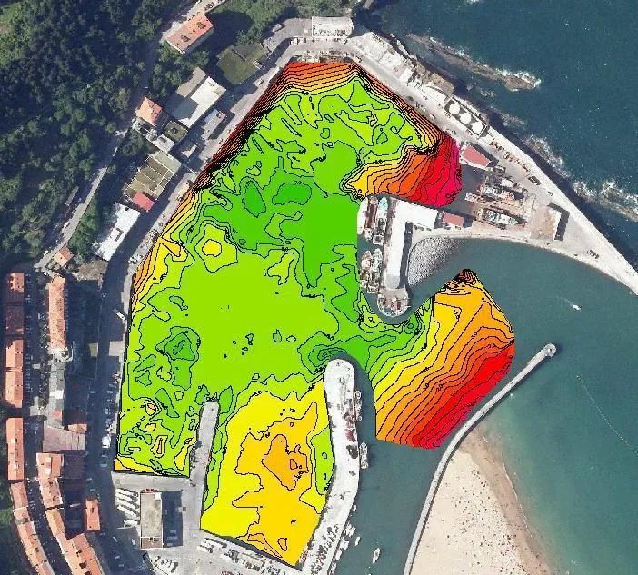
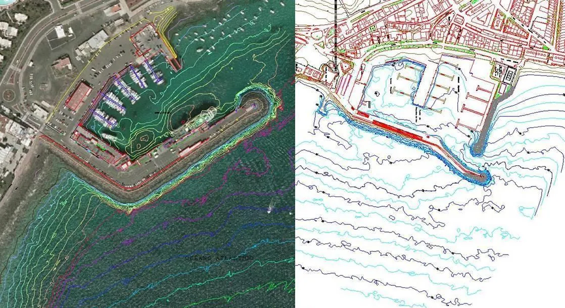
Harbour survey with isobaths and coloured model.
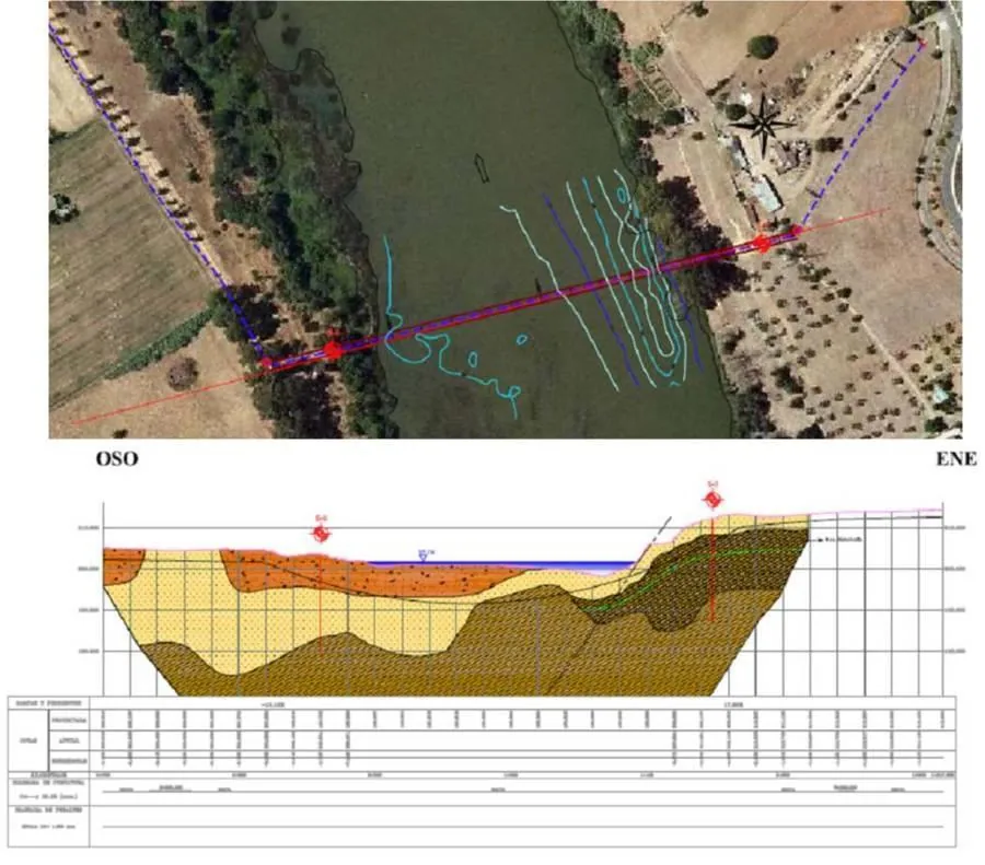
Seabed sediment distribution and stratigraphy.
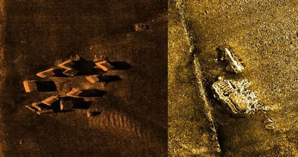
Targets and debris on the seabed from side scan.
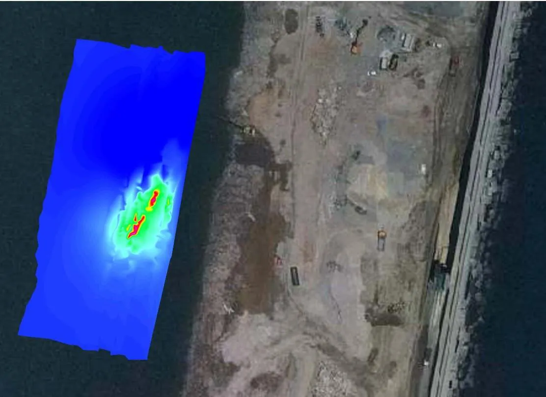
Magnetic anomalies over the survey chart.
CS Marineland runs every project under an integrated HSEQ management system — independently certified and formally licensed for marine and oil & gas operations.
Certified scope (Bureau Veritas): Hydrography, marine geophysics, and consultancy in submarine cables.
Certified by Bureau Veritas — ONAC-accredited (ISO/IEC 17021-1). Third-party, internationally recognised conformity assessment.
Licencia de Explotación Comercial No. 401542 — authorised for marine research and subsea infrastructure works in Colombian waters (valid to 2029).
Download licenseMember of the International Cable Protection Committee — aligned with global standards for the safe survey, installation and protection of submarine cables.
CS Marineland operates under a corporate policy framework approved by senior management and aligned with international standards on human rights, business ethics, labour practices and sustainability. Every commitment below is formalised, documented and applied across our projects — and available to download.
Our approach is built on four pillars: environmental, social, health & safety, and governance & ethics.
Marine ecosystem protection, pollution and spill prevention, waste management, energy efficiency and carbon-footprint reduction, acoustic mitigation and marine fauna protection.
Talent development, equity, respect for human rights and positive impact on communities.
Safe operations, a zero-fatality goal and team wellbeing.
Transparency, business ethics, anti-corruption and alignment with international standards.
CS Marineland is committed to the Ten Principles of the United Nations Global Compact on human rights, labour standards, environment and anti-corruption (formal membership under evaluation). We contribute to the UN Sustainable Development Goals (SDGs):
Integrated waste management under MARPOL and colour-coding.
Ecosystem and marine fauna protection, with marine mammal observation (MMO/PAM).
Energy efficiency and emissions control.
Environmental training and culture across the team.
Certificates, corporate policies and compliance documents — available for direct PDF download.
All documents in PDF. Certifications issued by Bureau Veritas, ONAC-accredited (ISO/IEC 17021-1).
We grow with people who have stood on deck. If offshore survey and submarine cable work is your field, we'd like to hear from you.
Field-proven talent, room to grow.
CS Marineland runs demanding marine geophysical and submarine cable campaigns across the Caribbean and Latin America. We look for hydrographic surveyors, geophysicists, data processors, offshore technicians, ROV/AUV pilots, divers and project engineers — plus interns starting out.
Send us your CV and we'll keep it on file for the roles that fit. Tell us your discipline, certifications and availability.
Email your CV as PDF, with your discipline and certifications in the subject line. We review every application.
Email your CVCV to gerencia@csmarineland.com
Tell us about your survey or cable scope and we'll come back with an approach, a schedule and a clear price.